Squamish, British Columbia, Canada
- Oct 14, 2018
- 4 min read
Updated: Jun 19, 2021

The town of Squamish is a hidden gem located between metropolitan Vancouver City and the affluent ski town of Whistler, slightly at the north end of Howe Sound. Home to the indigenous people of Squamish since time immemorial, it is now a hot bed for adventurers and thrill-seekers. Upon arriving here, I wikepedia'ed the place and I am proud to say that our presence here had just increased the Chinese population by 1.02 percent!
The size of Squamish territory is rather large, encompassing an area of approximately 6,732 square kilometers, or about 4.3 times the size of Oahu island, my present home. The three main rivers that run through Squamish valley are Squamish, Mamquam and Cheakamus.

Due to the tremendous amount of water gushing through the rivers as the ice-cap mountains melt during the warmer months, several large rivers like Mamquam had been dam to generate hydroelectric power that is distributed by BC Hydro. While we were in the vicinity in the month of June, we decided to pay homage to powerful waterfalls that fed the Squamish river in the upper Squamish valley. We drove on a utility service road that ran parallel to the Squamish river; crossing several bridges en route to the trail head. This led to Ashlu Creek, one of the upper tributaries of the Squamish river, where trailhead is located just before the Ashlu Creek run-of-river hydroelectric power generating plant. As we approached the access point, we had our first glimpse of the waterfall we were about to hike to.

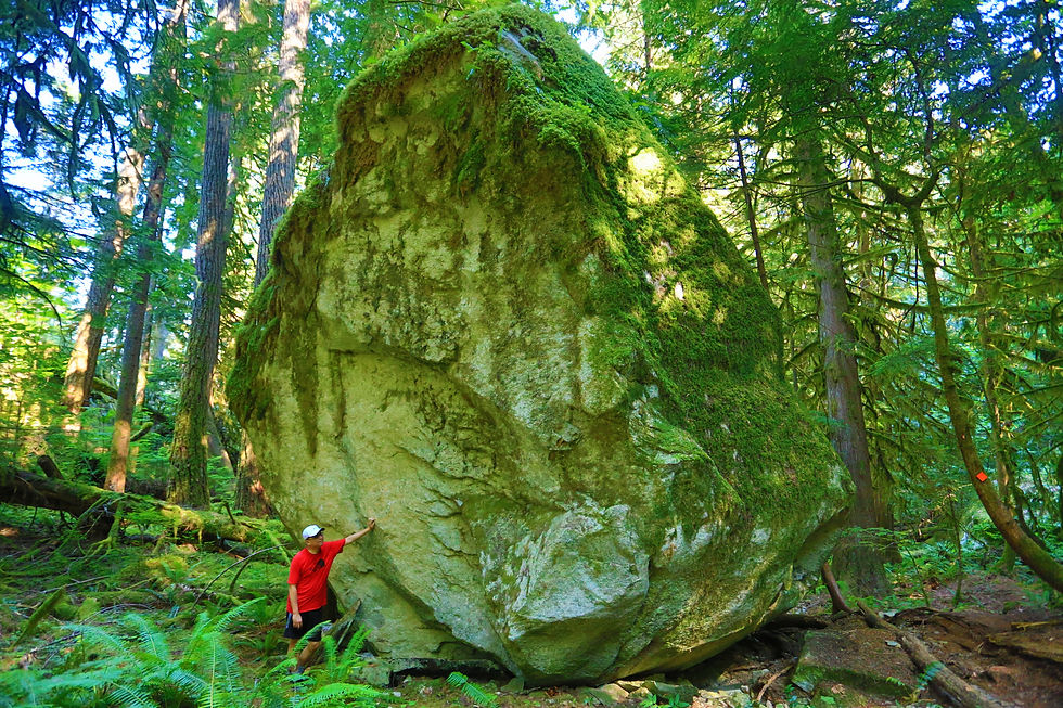
The Sigurd Creek trail was well marked and properly maintained. It was an easy tramp cutting across the lush mossy forest over a trail covered in dead leaves. The elevation gain was gradual at first before becoming steeper and contouring past huge rocks and fallen trees.

On the steeper slopes heading up the incline, we came upon a trail junction that marked the way to either Crooked Falls or to continue on Sigurd Trail to the Ossa/Pelion Mountains. It was tempting to want to continue on to the snow line on Pelion, but that was to be reserved for another day.

As we neared the falls, the sound of the roaring waters was deafening and soon, it was almost impossible to hear each other. As the water broke over the rocks, powerful mist blanketed the air , and we were drenched from head to toe.

The experience was surreal with the sun shining through the millions of water droplets, creating a double rainbow across the waterfall; a good omen accompanying a wonderful hike.

No adventure is complete without a journey into the backcountry. Before Squamish became so popular among adventure seekers and tourists, it was primarily a logging community whose main businesses revolved around the processing and transportation of logs from the area. Most of the pulp and saw mills were shuttered in the late 2000's.
Many of the backcountry roads in upper Squamish were originally built to facilitate the moving of logs across vast valleys and difficult terrain. One such road is the Mamquam Forest Service Road, which is the only route that will take us to our adventure hike to Watersprite Lake; a turquoise alpine lake surrounded by majestic peaks.
As with all 4WD roads, one would expect the occasional bumps and slides . But this one takes it up another level - there were sections where the road is literally hanging on the cliff edge with over thousands of feet drop-offs on either side. Staying focus on the 4WD road was difficult when driving in such a scenic environment.

The Watersprite Summer Route is a new route maintained by the British Columbia Mountain Club. The old route was closed due to excessive wear and tear; and in recent years, they found that the old route traverses some biological sensitive areas. The new route contours up the mountain following old disuse logging paths, which took us pass many ridges and scenic viewpoints.

The start of the trail to Watersprite Lake meanders through a lush forest as we slowly make our way up the side of the mountain. It passes many creeks and fallen trees, before the trail opens up to a scenic ridge hike.

The open ridge hike was a welcoming change as we could see across the creek and through to the surrounding snow-capped mountains. The air was cool even with the cloudless sky and the sun beating down on us in this mid summers day. This portion of the hike seemed long, but soon we arrived on a point known as The Prow Lookout. Here the view was just amazing. One could see into the entire valley, across the Mamquam river, and up towards the Tantalus mountain range and Garibaldi peaks.

From here, it would be another mile before reaching our final destination, the Watersprite Lake. But before that, we had to scramble past a poorly marked, and slightly treacherous area - the boulder section. From the sight of it, a landslide or a rock avalanche occurred sometime in the past, with large boulders and rocks strewn all across the face of the mountain, taking out all the vegetation and trees that stood in their way. Crossing this section in thick snow or ice would prove to be quite hazardous.

Once across the rock field, the final section just before reaching the lake requires a steep ascend after crossing a raging stream. The good thing was that there is a newly installed bridge. We had to put on our light traction spikes for added grip across the ice as we near the top. The going was slow with a few occasions of slipping and sliding across the hard packed snow.

After 6 miles of hiking, we finally reached the lake. On the lake's edge, perched on top of a small hill is a newly built cabin. Officially opened in 2017, it can house up to 10 hikers a night.

We made our way around the cabin and towards the edge of the lake for a better look. There was still plenty of ice and snow covering most of the surface of the lake. Nevertheless, it was a beautiful sight to end this long hike with and to marvel at the beauty of nature.

These are but just a few of the many adventures that Squamish has to offer. Whether your'e an adventurer, a nature lover, or a tourist happen to be passing by, there is something here for everyone. No wonder the town's slogan is "Hardwired for Adventure".
For additional information visit:
https://www.exploresquamish.com/
https://squamish.ca/
https://www.youtube.com/watch?v=9eLqxcAlSps


Comments