
San Francisco & Bay Area ft. Yosemite National Park and Mono Lake
- Jun 17, 2025
- 34 min read
Updated: Jul 10, 2025
This will be our 6th trip to S.F. and the Bay Area. Our first ever trip here was at the end of 1996 over New Years. Back then, all we could afford was a room at the Travelodge Motel.

On our second trip over the new years of 2016-2017, we managed to drive to Yosemite National Park, our very first time to this park.

In April of 2017, we got back to S.F. and spent some time hiking at Yosemite's Hetch Hetchy valley.

Again, we return in February of 2022 in an attempt to photograph the elusive Firefall of Horsetail Fall over El Capitan. Unfortunately, there wasn't adequate water flowing down.

Our last visit to S.F. and the Bay Area was in February 2023. One of the highlights of this trip was taking a helicopter ride over the city It was also a time of extreme cold weather that brought snow to the lower hills around the Bay Area.
Day 1 - Flight from Kailua-Kona to SFO
Finally, it was the day to hop onto our flight to San Francisco!

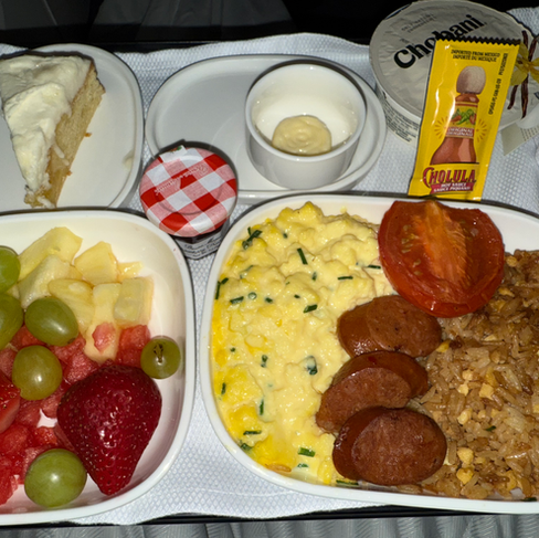
This is a direct 4.83 hour long flight with one meal on a very old 777-200. United allows it's Premiere/ business class passengers to preorder the meals 5 days before departure. So we excitedly pre-ordered the Salmon dinner online. Unfortunately, the meal was pretty mediocre...

The flight itself was pretty smooth and uneventful. With a strong tailwind it made for a very speedy flight that came in under 4.5 hours! The timing of our landing was just perfect as it coincided with the sunset over the bay.
Before heading to our vacation home, we had to stop for a quick dinner. So, we found a late night Vietnamese/Filipino restaurant in San Jose. It was packed with customers even at 11 pm! This place was lit up like Las Vegas!

We finally made it to our vacation home tucked away in the rolling hills of Sunol. What a beautiful home it is! Can't wait to see what it looks like in the daytime first thing tomorrow morning!


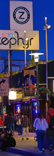
Day 2 - A Very Windy Walk Across Golden Gate
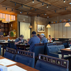
We started the day off trying out a new Malaysian restaurant we haven't tried before - Ipoh Garden Malaysian Cuisine. It was early in the day as they had just opened at 11am. Hence, we were the only ones in the restaurant. We ordered the Penang Hokkien Prawn Mee and Hainan Chicken Rice. Sad to say that both dishes were not up to par. In fact, they tasted nothing like it. The prawn mee broth was terrible and the soup was not even hot. The rice tasted like left over rice scraped from the bottom of the pot. We definitely would never go there again!


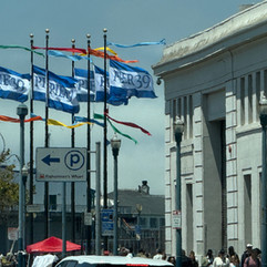
We then drove north to the Golden Gate Bridge via Pacifica and Daly City. Although today was the Juneteenth holiday, there were still many people up and about. Traffic was heavy but at least moving. We parked at Presidio, near the Golden Gate Overlook. From here, we walked the Coastal Trail to the bridge. There were many bunkers and batteries along the way; all dressed up with colorful graffiti.


It was clear why this spot was called the Golden Gate Bridge overlook; especially since it provided for a clear line of sight down the bridge.

Once on the bridge, the wind was strong, and it was quite chilly. Someone once said if you want to experience what winter in San Francisco is like, visit during the summertime.
There were many people roaming the grounds around the bridge, from foreign tourists soaking in the views to local hard core cyclists. Here is the link to the walk.
The Golden Gate Bridge walk did provide some interesting views that can only be gotten while on the bridge. These made for an interesting collection of photos. It was unfortunate that although it was very sunny, the wind made it very cold.


And the sound coming from the wind passing over the cables of the suspension bridge was incredibly loud. This aeolian process would loudly make itself known as the wind speed caused a resonance with certain cable lengths along the way. In this case we could see one of the lamp posts resonating with the wind.
Our walk across the bridge and back took a total of approximately 1.5 hours and was just under 4 miles. I wouldn't say that it was bad, but this walk was definitely urban. Just too many people, lots of car noise, and the because they closed one side for repair, it was a hassle to have bikers and pedestrians together going both directions on the same side. We would be hard pressed to do this one again.
From Presidio, we then drove on through the Marina and onto Embarcadero. There were some tourists but not as many as we had seen pre-Covid. I don't think we will have many foreign tourists as the exchange rates would be unfavorable to the US dollar and the USA hasn't really been very inviting in our foreign policies of late.


Since we did not know that the San Francisco Giants were playing the Cleveland Guardians at Oracle Park today, we got caught in a really bad traffic jam leading up to and pass the stadium. There were lots of fans spilling out of the stadium as the Giants beat the Guardians.

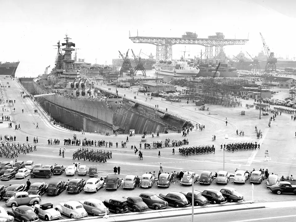
We proceeded to drive on to Hunters Point since we were curious about the area. There were some pretty affordable new units in the area starting at about $500K. These units sit on a bluff above a Naval Shipyard that has since been retired from service. However, the navy has yet to completely clean up the area that is considered toxic from nuclear waste. This has caused potential buyers to hesitate as forever chemicals and radiation are present. From the bluff above the shipyard, one can see the massive crane and docks. It must have been a sight to see.

We ended our day by stopping by Curry Leaves Bistro in Pleasanton. We had been dreaming about his Nasi Kandar for a while now. We ordered out and it certainly was not disappointing. Yum! Best way to end the day.


Day 3 - Happy Summer Solstice Day!
The day started bright and early at 5:46am. It will be the longest day today with the sun expected to set only at 8:47pm tonight. It was nice seeing the sunrise over the hills to the east of us over Sunol.

We decided to pay a visit to Little Saigon in San Jose. This is the one of the largest concentration of Vietnamese people in the USA, behind Orange County, Houston and LA. Specifically, we went to have lunch at a place called Pho Dang that specializes specifically in Pho. This restaurant is located in Vietnam Town; an upscale Vietnamese shopping center. Our pho bowls were large and the vegetables were very fresh.


Having had our fill we then proceeded to drive around San Jose pass the massive buildings of Nvidia's head offices called Voyager and Endeavor (named like so after Star Trek starships).

We then proceeded to Google's head office massive campus. They had a Google Store and large ground sculptures. They even provide staff with free Google colored bikes and e-Busses to get around the campus. This was quite impressive and tiring at the same time!


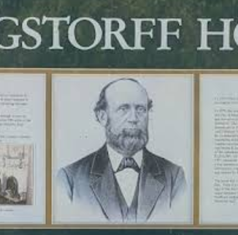
At the back of Google's campus towards the bay is a golf, lake and bicycling park called Shoreline. Curiously, there is the Rengstorf House located here near the lake that is available for receptions and weddings. Its an old Victorian house owned by one of the early pioneers to California.


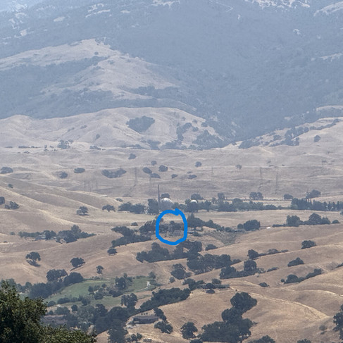
Having had enough of the city, we then drove out through the winding Calaveras Road to the Sunol Regional State Park. Here we saw the incredible rolling hills up close, along with the Calaveras Reservoir. At the park itself, it wasn't very busy as it was hot and very windy. We also drove along the the Welch Creek Road, where we caught the site of a large Condor perched on a nearby tree. It certainly looked like Deadpool's cousin! We didn't hike here today, but we certainly will be back.


Soon it was time for dinner, but it was still so bright out pass 7pm. So we had another great meal from Curry Leaves Bistro! This time we had the Nasi Lemak Fried Chicken and Hainan Chicken Rice. Just as good as ever! To work off the extra pounds, we decided to walk the full length and back of Little Valley Road. It turned out to be a pretty good workout as there were rolling hills and great scenery along the way. There were also many animals along the way - from turkeys, and horses, to alpacas. In all, it was about 3 miles in less than an hour.


The sun finally set just before 9pm; as the longest day of the year came to an end.
Day 4 - Urban Walkabout : Twin Peaks & Sutro Peak Loop
The day started with more Vietnamese noodles down at Little Saigon in San Jose at Bun Bo Hue An Nam. The place was packed! We had the Bun Bo Hue and Pho Bo. This is a cash and debit card only place, so it is unlikely that we will be returning. Although they say that they are passing the savings of the credit card fees to customers, it seems like their prices are still high as two bowls of soup and one drink, plus 15% tips came to $55.


We went back into SF city and tried out this urban trail called Twin Peaks & Mount Sutro Loop highly recommended by Alltrails. It surely did not disappoint. I was expecting it to be mostly walking on paved roads but it turned out to be mostly walking thru single-track trails under a forested canopy. It was quite a chilly day even though the sun was out in full force. The wind did die down later - which made it more comfortable for a day out in the open. In all this was a nice mix of urban walking, including Briarwood and Ashland Lane stairs.


After our walk , we rewarded ourselves with a nice refreshing drink from Yifang, which they also have a branch in Honolulu. They are known for their tea-infused fruity drinks.


We were exhausted by the time we got back from the drive and decided to just do a take-away from a new place called Bui Vien Street food. Again, this restaurant was packed with customers and we had to wait for 45 minutes for our orders.


Day 5 - Little Saigon, Japan Town & Exploring Bernal Heights
Today we wanted to drive around Little Saigon in San Jose to see the full area and what it entailed. So far we had blindly picked Vietnamese restaurants and the result has been mediocre. This time we drove around and looked at the Yelp Reviews to make our pick. Vietnam Town is about three square blocks along Story Road between McLaughlin Avenue and Lucretia Avenue; and it makes up a good portion of Little Saigon. It was interesting to find out that Vietnam Town is actually owned by a Singaporean public company! See their main page here.
After canvassing the area, we decided on a Vietnamese Cafe and Restaurant whose name is not common amongst Vietnamese restaurants - Nem Nuong Nha Trang; meaning Grilled Pork Sausage from a coastal city in Vietnam called Nha Trang. The pork sausage rolls were very good and well deserving of the 4.9 out of 5 rating. We definitely will be back for more!


From here we took the drive up north to San Francisco city along Interstate 280. This was a smooth drive, with average speeds of 80 mph. This route is nice and green, cutting through Mountain View, Los Altos, Stanford, Menlo Park, Emerald Hills and down to Pacifica. You can even catch a glimpse of the Upper and Lower Crystal Springs Reservoirs, and the San Andreas Lake. Of course, once we arrived at San Francisco city limits the traffic was heavier even for a Sunday.
After driving through Sunset, Presidio and Sea Cliff, we then proceeded to look for some Taiwanese real fruit tea. So we paid a visit to Japan town. It was a bit hectic as the Cultural Center is being renovated. Nonetheless, we found our favorite fruit tea shop Yifeng. Japan town is a curious place with Japanese cultural activities, but folks mostly visiting for the food.


Having had our fill of Yifeng's Mango Palmalo Sago and Yukult Lychee Teas, we then made out way to Bernal Heights as we wanted to see the most steep road in San Francisco - Bradford Road - coming in at a 41% gradient. Unfortunately, the area in which the steep slope was at, was not as inviting since there were many cars parked on the street and it was looking rather run down. So we continued up to Bernal Heights to get our exercise on yet another hill in San Francisco. Bernal Heights is closer to downtown and the bay, and it seems to be a favorite walking area for the local residents. It also seemed to be a place with many Muslims. It was nice to see the mix of folks enjoying the beautiful sunny day.

The view of the major 101 and 280 interchange can be seen here from the top of Bernal to the south. Its amazing how close all the housing is to the highways.

When we were on Sutro, we didn't visit the "Christmas Tree". But from Bernal Heights we could clearly see the pink "Christmas Tree"!

There were several points of interest either on or seen from Bernal Heights. It made for an interesting view of the city and its inhabitants.


It was amazing to see the streets of San Francisco packed with people and the traffic heavy even on a Sunday. There were several "No King" protests happening around downtown and city hall, so we stayed away from these areas. Our drive back to Sunol would take just over an hour through the San Mateo bridge. Although traffic was heavy, it was at least constantly moving. I'd hate to be stuck here at peak time(!)
To end our day we just had to have our favorite Malaysian Restaurant fare at Layang Layang. We order the Penang Prawn Mee and the Malaysian Wonton Mee. As always the food was authentic and very tasty!


Day 6 - Hiking The Courdet Trail, Pleasanton, CA
The summer is here in full swing. The air is warm, dry and the sun is out in full force. So, I decided to do a solo hike up Pleasanton Ridge, starting from the Castleridge Trailhead. The trail was dry and dusty.

I did encounter several hikers and a lone mountain biker. Took me slightly less than 2 hours to complete this 4.3 mile uphill trail. The views up here is amazing, as one can see as far as Mount Diablo, the township of Dublin & Pleasanton, and Sunol valley. I could even see our Little Valley House from here!


On the way down, several Sikorsky Firehawks from Cal Fire flew by above heading towards Mount Diablo to fight some brush fires. The surrounding hills and grassland are parch and prone to fire flaring up at any moment. Hikers beware!
This evening we tried a different Vietnamese restaurant called Viet Nom, this time in Livermore. This place was in the middle of Livermore's main drag off Stanley Boulevard. We ordered their Shaken Beef with Fillet Mignon Rice Plate, their chicken salad, two salad rolls and chicken wings. All the food was fresh and tasty!

Day 7 - Sunol Ridge Trail To Sunol Peak
I drove to Livermore to have my brunch before I began my solo hike to the top of Sunol Ridge. I found a place called Saigon Cafe and I ordered the Beef Pho with Eye Round Steak. Nothing special about it but it kept me warm and filled.


Having had my fill, I then drove past the quaint town of Sunol to where the trailhead is situated. Per the 2020 census, Sunol has less than 1000 residents and it is known for its historic railway and water temple. I think I would like to revisit this quaint town for its rich historic past.
When I arrived at Tyler's Ranch Trailhead, there was only one other vehicle parked. Later I would learn the reason why... The trail was fully exposed with no shade all the way, and it was mostly walking on a rutted 4WD dirt road. The wind was relentless but it kept me cool the entire time. It was a good thing that I brought my water bottle with me as the air was very dry with the sun beating down on my head and neck. Regardless, this is a great workout, and it is certainly a good warm up to help me get ready for our hikes at Yosemite National Park next week. Here is the video of this hike.


To end the day we picked up our dinner from Layang Layang. This time we tried their Hainanese Chicken Rice. The chicken was a bit rubbery this time. But the Penang Hokkien Prawn Mee was still delicious!

Day 8 - Visiting Del Valle Regional Park
Around Sunol, there is Pleasanton to the north and Livermore to the northeast. All around us are rolling hills for ranching and wineries. To the south is the San Antonio Reservoir, and southeast Lake Del Valle.
The area around Lake Del Valle is a sprawling park used for hiking, biking and water sports. The geology of the area is quite interesting as nestled amongst the rolling hills are some steep cliffs created by geological faults and folding. The entire area is in essence a synclinal basin.

This regional park is huge! At 4,395 acres, it is also the eastern gateway to Ohlone Wilderness Trail. It is also quite popular, even on a weekday, but mostly by the water.

I decided to take a walk up towards the steep cliffs to a vantage point to view the full expanse of the lake. These trails are a mix use between hikers, bikers and horseback riders. It was pretty hot and exposed but there were a few oak trees that provided great stopping points along the way. This place was definitely more scenic than the prior hikes on Sunol or Pleasanton ridge. Imagine what it would look like when the grass is green. See my hike video here.


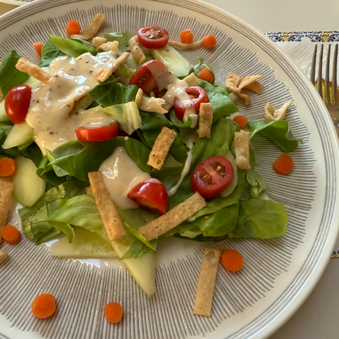
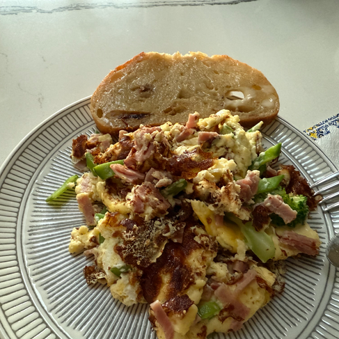
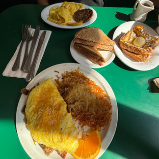
This time we didn't opt to eat out but instead decided to eat in. It was refreshing to have more greens this time, with a nice plate of salad, a broccoli, ham and carrot omelette and a slice of tomato artesian bread. Yum!


Day 9 - Rest Day & More Malaysian/Burmese Cuisine
As age is catching up, I need to rest my weary body and feed on more Malaysian goodies. We tried a place we haven't eaten before- Mingala located in Newark/Fremont. We ordered the Beef Rendang, Chicken Murtabak, Roti Pratha, and Shrimp Noodle. Every item was delicious and we will definitely come back here soon.


Day 10 - Del Valle Regional Park, Part 2 & Pride Flag
Today, the daytime temperature is forecasted to climb to 85 F. I woke up earlier than usual, had my breakfast and headed back to Del Valle Regional Park, but this time a different trailhead from the last one few days back. This trailhead starts at the top, and works it way down to the lake side. The morning breeze and cool ambient temperature was a welcoming condition for an early start before the sun heats up the area. As expected, the ground is parched. There are many side trails branching off the main ridgeline trail. I took some of them and it led me to a hidden canyon. This side trail was by far the best spot in the entire park. It had plenty of shade.

At the end of the Canyon Trai, there are 2 options: left to the boat ramp, or right to Hetch Hetchy Campground next to the lake. I opted for the latter. Once I arrived at the campground, it was void of people. I only saw one boat out on the lake. Is this the off-season perhaps?

From this low point, I climbed back up via the Ridgeline Trail, sometimes taking the unmarked side trail to the top of a hill for a better view.

All in all, this hike had a nice length and moderate steepness for a moderate workout. Perhaps it could be a better experience with a mountain bike! Here is the video of this hike.
After a short break back at the Little Valley House, we decided to check out the evening's pride celebrations in San Francisco City. We drove to Embarcadero Plaza where a crowd of colorful folks were having a drag show ahead of the main laser lighting event. Apparently this lighting of the laser rainbow was an annual event since the 90's. It took a break through the pandemic and this is the first time it has resumed.


Embarcadero Plaza is home to a newly installed (April 2025) 47 foot sculpture of a naked woman called R-Evolution. It was created by Marco Cochrane as the final sculpture in a series of 3 installations called The Bliss Project. It stands defiantly in front of the clock tower looking down Market Street.

Once lit, they also blue bubbles into the air, which made it glisten. It was nice to see the many people out and about and how a little light could brighten the air.


We drove to Twin Peaks but the road up to the top was closed. So we drove back down Market Street to catch the laser light sight all along the way. See the video of this even here.
On the way back, we stopped at Pho Mai for a late night dinner. The place was reasonably busy with college students. It was good to have the Bun Bo Hue and Banh Mi.


Day 11 - Coyote Point, Fort Baker, and Richmond Port
We started our day with brunch at Layang Layang. We had Prawn Mee and Nasi Lemak to start; followed by a Durian Shake from Pho Mai. Having had our fill we then wanted to see if we could do some plane spotting off SFO. So we drove to Coyote Point; a good Regional Park out in San Mateo. It is right on the flight path and we saw its boat harbor when we were landing.
Coyote Point Regional Park is about 92 acres. It has what looks like a manmade beach, eucalyptus trees, a children's discovery center, a firing range, and a boat harbor. There are several paved paths throughout the park as well as many areas to picnic.


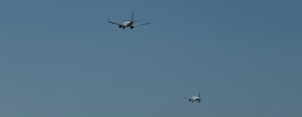


There were many planes of all shapes and sizes landing at SFO. The most interesting being the staggered side by side landings. We could also see Sutro Tower and the San Francisco city skyline.

Having taken a short walk around the park, we then opted to drive north towards Sausalito. Upon arriving, we decided to go down below the bridge to Fort Baker. We could see the the windy swirl of clouds hovering over Marin Headlands above the fort.
We could also see the immense fog that shrouded half of Golden Gate. Even though the sun was out in full force on our side of the bridge, it was pretty cold with the strong winds.


There were also these crazy wind surfers and para-sailers out on the bay. It was pretty cold, yet there they were. And although foggy, they were all out in the bay.


To escape the wind we then drove further north past San Quentin to Richmond, rounding the northern end of the Bay. We wanted to see Rosie the Riveter National Historical Park at Richmond Harbor. We stopped by the Columbia Employee Store and got an amazing deal of 50% off with our National Park Annual Pass.


We then drove down to the ferry and saw the fog obscure our view of the city. We could only see the very top of Sutro Tower.


As the fog rolled in, we made our way back to Sunol heading south on interstate 880. So we picked up dinner at Mingala. This time we tried their Burmese Tea Salad, Beef Rendang (which was actually a curry this time), chicken wings and roti canai. This time around the food wasn't so good. So we figured that they were not very consistent.


Day 12 - Sunol, Tracy & Livermore : Potential Retirement Destination?
We started our day with a nice bowl of fried rice. The leftover rice, Burmese Tea Salad and eggs made for a perfect combination and a power brunch. Now we were ready for our new adventure today. We wanted to see Sunol's Water Temple - so we drove west to the small town of Sunol. Unfortunately, we found that it was closed today. So we snapped a few shots of the main drag and decided to drive up Kilkare Road.


This is a narrow often one lane road that winds it way along the Sinbad Creek. It was previously badly damaged during a flood a few years back, but it now seems to be in good shape. Unfortunately, our timing wasn't so good as there were Core Crews out along the road doing tree cuttings. This made for a very slow stop and go drive to the end of the road. There is a trail at the end called Sinbad Creek Trail which takes one up to the top of Pleasanton Ridge. This was the end of the line for us.


We then decided to pick up two Durian shakes for our drive through Livermore to Tracy. We took the scenic route along Patterson Pass Road heading east through the hills. The highest point is called "Top of the World". Past this point the views open up and you can see all the wind mills of Mountain House and the plains towards Tracy.


In Tracy, we drove around the Toll Brother's new 55+ development called The Regency at Tracy Lakes. This is a luxury gated community with two manmade lakes as the main features. Not all the units have been purchased as yet and these single family homes start from about $699K. Maybe a good option for retirement! It was pretty hot today though. At 99 degrees F, it was scorching. The trees will need to grow to provide some shade!


We then drove north and then back west through Mountain House. Here we got to see the windmills up close. We could also see Interstate 205 above us and we also saw a hillside patch burnt crisp from a recent fire.


Since we were back in Livermore, we then drove up the hills to the Lookout point along Del Valle Road. Here we could see the valley and all of Livermore out pass Dublin to Mount Diablo. It was a really pretty location. We could also see the erosion and exposed slips along the valley cliffs. More synclinal folds and faults.


Today was our last night at Little Valley House. So we returned to pack and enjoy our final night. The twilight lighted up the hills with a warm glow. Perfect for a final night.


Day 13 - Driving to Yosemite & Beyond: Mono Lake Via Tioga Pass
After checking out, we drove directly to our next mountain house in Midpines, just 30 minutes outside of Yosemite NP. Traffic was light and we arrived at Midpine in just under 3 hours. We settled down rather quickly in our new place - called the Lilac House - for the next 5 days, and our new host Charles showed us around the place. The house was completed in April 2024, so it was all still very new.


Once settled in, we gathered our hiking gear and headed directly for Mono Lake. It was a hot day, with temperatures reaching almost triple digits in some areas. It was also our first time ever driving through Tioga Road to Tioga Pass, and beyond to Mono Lake. In the previous trips to Yosemite, the road was always closed due to ice. The drive was very smooth and picturesque. We stopped at Olmstead Point for a quick photograph of the backside of Yosemite Valley, prominently show casing Half Dome.

We didn't encounter that many people, unlike when we were inside the village of Ahwahnee. Tuolumne Meadows was very impressive, as it spans the valley floor in between the high sierra mountains. Again, there weren't that many campers, maybe a few camper vans far in between.


Past the Tioga Pass NPS Gate, we drove through Inyo National Forest to join up with Highway 395. The downhill approach was amazing as the road hugs a huge mountain with huge drop offs on one side.

We arrived at the town of Lee Vining in about 2 hours and we had to grab a quick bite from one of the local restaurants. We ordered Fish Tacos and a steak sandwich. To our surprise the steak sandwich was literally that... a piece of steak on a slice of bread! We drove to the Mono Lake Visitor Center and squeezed under a little bit of tree shade for our lunch. We ended up having two seagull friends loudly calling for morsels of food - fit for the seagulls but perhaps not so great for us.


We decided to visit the tufa near the boardwalk. We read that one should be able to hike around the full lake, but that would be a pretty long, soggy and hot hike. We just did a small section from the David Gaines Boardwalk. There were a lot of birds here feeding on the Alkali Flies. And the flies were swarming.


We then took a drive around the north side of the lake on Cemetery Road. This then turned into an unsealed 4WD forest service road called FS-2N20, that led to the Black Point parking lot. Here our Black Point Fissures hike started. It traversed uphill on an unmarked tramp through sage brush. This headed straight up past the highest point called Black Point to the fissures.


It was a hot and relatively difficult hike up hill due to the black sand. To top it off, the sage brush was prickly and made us walk in a zig zag around them. The fissures themselves were very interesting. The rocks were mostly rough looking like pumice. The shade was just perfect! We would have probably enjoyed this more if we didn't have to tramp through the sage!

By this time it was about just after 8pm. So it was time for us to be heading back to Midpines. The drive was again very enjoyable, with the sky lit up with the sunset glow followed by twilight. It was a long winding drive though, cutting across the full length of Yosemite in one go.

We were definitely knackered and fell asleep in our little Lilac home for a sound dreamless and restful sleep. Here is the video to our adventure.
Day 14 - More hiking inside Yosemite National Park
We started our day with a Japanese ramen brunch at the Little Ramen Shop in Mariposa. This place was a bit strange as you walked in, its atmosphere was that of a bar. Huge bar in the middle and large paintings on the walls of sailors and sailing ships... We had to double check to make sure we were in the right place, and we were. We both tried their Sho-Mi Ramen and it was quite tasty. If you looked hard enough, we could then see some of the Japanese decor(!)


For the many years that we have been visiting Yosemite, we have never made it to Glacier Point of the many points in and around that area. To closest we got was in the winter snowshoeing at Badger's Pass. This time we went back into the heart of Yosemite and did a loop around Sentinel Dome, starting from Glacier Point Road to Taft Point, then continued on the cliffside trail to Roosevelt Point, then up the switchback trail and skirted around Sentinel Dome until we rejoined back onto Glacier Point Road and back to the car.

We were pleasantly surprised that there weren't as many people on the trail, especially on the cliffside. Most were walking along the Sentinel Dome Trail. This hike has a nice mix of shaded forest and granite cliffs.


The views were just out-of-this-world and the hike experience is something everyone should try. Here is the link to the hike.

After our hike we then drove to Glacier and Washburn Points. Here we could see Half Dome with Nevada and Vernal Falls.


On our way back, we decided to take the longer road through Wawona past Mariposa Grove. This was also a winding road through thick forests. It then opened up to a great big meadow where the Wawona camp grounds are located. Soon were were heading south on Highway 41 past Fish Camp and Oakhurst. We stopped at the Carl's Jr. to pick up our dinner before heading up on Highway 49 back to Mariposa. It was a scenic drive through many small towns like Ahwahnee and Nippinnawasee. These little towns make Kailua-Kona feels like a big city!

We ended our day by having our dinner at the Lilac House outside by the pergola. We could see the sun setting across the mountains, lighting up the sky with an orange glow.

We couldn't have asked for a better way to end the day.
Day 15 - Mount Hoffmann Via May Lake, Yosemite NP Backcountry
We started our day early this time as we wanted to do a full days hike off Tioga Road. So we made our way to Happy Burgers for a quick yet heavy breakfast. But nothing in Mariposa is quick. There is an innate slowness in this place, as people speak more slowly, service is slower, and time seems to stand still. We had our fill of a typical American breakfast, with eggs, sausage, pancakes, and hash browns.


We have been wanting to climb Mt. Hoffmann from our past trips but just couldn't find the time to do it. Finally, we dedicated a day for this hike, and climbed to the top via May Lake.

AllTrails rated this hike as advance/difficult but we found it mostly a cardiovascular workout and it is only really difficult if one is truly out of shape. The last section involves some Class 2 rock scrambling to the summit. This is what we found to be the most challenging part of the hike itself, especially if it is your first time, such as it was for us.


The nicest thing I found about this hike is how quiet it was. It's all about yourself and the mountain. In the silence we could hear the occasional Pika and Marmot.

The views at the summit were incredible. It provided for a 360 degrees of unobstructed views across the high sierras. We could see Red Mountain and the Clark Range in the distance, Cloud Rest and Half Dome.

There were many lakes around the area, from May Lake to Tenaya, and the many others that have no names. Another factor to take into account is the weather. We had the full sun, with temperatures hovering around the mid 70's to 80's. Towards the end of our hike the clouds had set in and we could see huge thunder clouds coming in from the east. We heard several loud claps of thunder as we reached our car.

What made this hike successful for us was the fact that we brought enough water in our Camelback and a flask filled with ice; which is always great to have on a hot dry day. Other than that, it's was one foot forward at a time. We made it to the top in 3 hours. Here is the video of the hike.
On our way back, we decided to try the Chinese restaurant in Mariposa called China Station. Unfortunately, when we arrived, the restaurant was unexpectantly closed. So we decided o try the Mexican Restaurant called Nayo's next door. The place was filled with Mexican speaking patrons, and a friendly server at the front counter. The restaurant was not full as only two tables were occupied, with one waiting patron to go, and one small family ahead of my order.


Apparently there was only one cook in the kitchen and the food was made to order. So our 25 estimated wait turned out to be about 55 minutes instead!! We order three fresh beef tacos and the Nayo's Steak Ranchero (grilled steak with rice, beans, salad and spicy habaneros). Well it certainly was worth the wait, as the food was delicious!
Day 16 - Rest Day and Taking it Easy Roaming Around Yosemite
Today started slow as we were taking it easy and enjoying the slow pace of the place. We had a customary repeat of the American breakfast only this time with a twist as we ordered a Taco Beef Salad, and more pancakes, sausage, and eggs.


We then took a drive to the Yosemite floor. Along the way we stopped along the El Portal 140 Highway drive to take in the sight of Elephant Rock and the mighty Merced river. It was very pleasant here as there were only two other couples picnicking on the sandy river's beaches. The water was amazingly cool and clear. Its water levels the lowest we have ever seen it.

Along the drive in there were also many places to stop and learn about Yosemite Valley. We stopped at an unnamed waterfall; of which we had driven by everyday since we got here. There are many waterfalls along the valley walls - with the most famous being Yosemite Falls.


As expected there were a lot of folks in the valley. Still not as full as we have seen it in the past, but at least a decent number of visitors. We managed to catch sight of Taft Point from below. It was incredible to think that we were up on the point just two days ago.

There have been at least 4 documented deaths from this point. One incident involved an intoxicated couple and the other being two wingsuit enthusiasts doing an illegal jump. I guess beauty has a price especially for those who want to test fate.
It was sad though that for some the valley is the only Yosemite that they will ever know. It is very crowded with every "instagraming" person in the way of Yosemite's natural beauty. Cars in the valley don't drive slowly. Instead they are zooming off from point to point, like as though there is a race to see all points of interest in the valley. There are the rare moments when one does look up and away from the cars and crowds, and you will get a glimpse of what the backcountry is like - majestic views and might mountains of granite.

We left the valley floor feeling relieved to be back in the real country. But don't get me wrong, it is great that the national parks makes the wilderness accessible to all; as it should be. But if you can, visit the backcountry to truly getaway from it all. The sun was setting as we arrived at the Lilac House. Yet another spectacular sunset!

Day 17 - Drive from Midpines to San Jose and 4th of July Fireworks
It was time for us to head back into the city, so we decided to take the southern route through Modesto and Las Banos, past the San Luis reservoir/pass. This would take us through hilly country, to open expansive flat farming lands, and back up and through more hills before arriving in San Jose. If you are into fresh fruits, then there were plenty along the way - direct from the farmers in the area.


It was weird being back in town. Busy traffic and of course the corresponding traffic jams! But we are after all city folk... This night we decided to see the San Francisco 4th of July Fireworks down by Pier 39. We knew it would be packed and that parking would be a challenge. But we were up to it! Of course we had to have some dinner beforehand, so we stopped at a place in Noe Valley called Le Quy (leh ku). Fancy spot for pho! Even the soup bowl was sizzling!


Having had our fill, we had about 2.5 hours to kill before the fireworks. Driving around we could already see the many folks starting to converge on Pier 39. All the streets leading up to the area inclusive of Telegraph Hill was packed with people and cars. Not a single parking spot available on the street! Little Italy in front of St. Peter and Paul's Church was busy with folks in and around the park.


Soon it was around 8pm that we finally found a spot to park at Nob Hill. We then took a good hike up and down Taylor to Ina Coolbrith Park where there were beautiful views of Coit Tower and the downtown skyline against the now pink sky.


As we made our way down Mason Street towards the Fisherman's Wharf, we could see the lighted ferris wheel called the Sky Star Wheel in the distance. We could also see all the cars stuck in a jam heading down Mason Street.

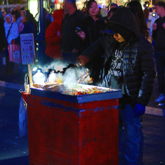
Thankfully we were walking. The streets surrounding the wharf were closed to cars and people were already gathered at the piers. There were several street food stalls selling hot dogs (Mexican style).


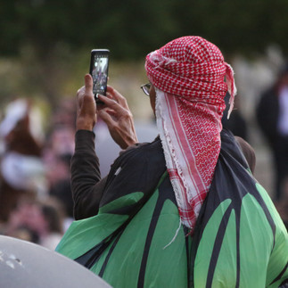
There were several interesting folks that stood out from the crowd along with those making political statements at this curious point in time of the US administration. Thankfully, most were here just to have fun and to see the fireworks.


As we waited, there were a few interesting textures around the wharf. It was nice to see how it all blended in with the crowd, yet stood out differently when photographed in a particular way.


Finally, it was 9:35pm and the fireworks started. Just before, the San Francisco's Fire Department's T13 stopped behind us to watch the fireworks as well as to be on call should anything go awry. It was good to see them out, enjoying the fireworks while at work!


The fireworks lasted for a good 20 minutes. There were hearts, stars, the usual ball explosions and a few new ones that exploded in stages. In all, it was a good set of fireworks that gave the crowd a great show.

By the time it was all said and done, we walked back to our car and headed back to San Jose. It took us about two hours to get back (walk and drive), so it was well past midnight by the time we went to sleep. In all it was a long but well worth while day. See our fireworks adventure here.
Day 18 - Taking it easy with more Vietnamese food and Malaysian fare
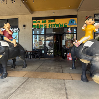
We were pretty knackerred from the prior day's drive and activities. Plus walking around San Francisco city is already a good way to exercise, but our knees were letting us know that it was time for a break. So we decided to do nothing today but have some good food! We tried a new Vietnamese restaurant called Bún Bò Huế Sông Hương. This restaurant is rated as the best Bun Bo Hue in San Jose, so we had to try it. Located in the heart of Little Saigon we found the quantity of meats to be great and the bowls of soup quite satisfying. But its not the best we have had. Though it was reasonably good.


Having had our lunch we stopped by Pho Mai for our customary Durian shakes. Nobody makes them better than this place. They were gone in a few minutes as the sun was out in full force making us retreat back to our house. This gave us time to unwind, finish up our catch up blog, and stay indoors with the air conditioning. By dinner time, we already knew that we had to have another round of Curry Leaves Cafe's nasi kandar and nasi lemak. If anything, this is why we keep coming back to the area!
Day 19 - San Francisco 49 Mile Scenic Drive
The one and only time we did the full drive was way back in 1996, when we first visited. The idea is to follow the seagull signs along the route. On researching the drive, we found that there is actually a walking version of it too - recommended to be completed over 5 days. See link here for more information on this.


Now if I can only figure out how to get Google turn by turn directions on this...
We made our way to the Capital building in downtown SF to start our scenic drive. Following the map without the turn by turn was a bit of a challenge, and in certain places the seagull sign was missing(!) But we did the best we could driving anti-clockwise.
The first section takes you through downtown capital building then to Union Square, then back up California Avenue for a sight of the steep tram road. We passed Grace Cathedral on Nob Hill and then down to Chinatown. We proceed through Little Italy past Coit Tower and on to Lombard. We then headed back down to the Fisherman's Wharf and past the Marina. This is an especially nice section of the drive into Presidio and then on to Land's End. There we drove past Sea Cliffs and Sutro Baths, down to Sunset, past the entrance to Golden Gate Park and the Ocean Beach. We ended our drive at Lake Merced - where unfortunately there were rows and rows of homeless campers.


There are such stark contrasts - from the modern to the traditional.


This took us about 2 hours to complete and by then the fog had settled in. So we decided to end our drive here. There were interesting things along the way, but we have been here so many times already that nothing we passed was new or something that we haven't seen before. The Lake Merced area is a particular place of contrast too; from the homeless to the lake waters, and the golf course.


The weather was also very different - from the very sunny and hot, to the very foggy and cold temperatures. All experienced in the span of the drive.
It was fun doing this again after almost 30 years. Some roads are not the same - as the Grand Highway is blocked on one section and the Martin Luther King Blvd in Golden Gate is now one way. I guess we will have to do this again in another 10 or 20 years!
Day 20 - Russian Hill Walkabout
Our day started with a salad and roti canai with chicken curry! It was a good brunch and soon we were ready to head back into town. This time we went north via interstate 880 to Oakland, then across the Bay Bridge to Embarcadero, and finally to Bay Street and Larkin, where our Russian Hill walkabout starts.


Francisco Park was established in 2022. It was previously an old reservoir that was originally established in 1860 and subsequently decommissioned in 1940. It sat unused until 2014 when it was finally turned over to the city's Recreation and Parks Department. Private funds and donations were finally used over the remaining years to build the park with the help from the Francisco Park Conservancy. It turned out quite well and it is definitely much better than the sore eyes it used to be.


From here we made our way up the Larkin Stairs to Hyde Street past Lombard Street to the Greenwich Pathway. We then turned south on Leavenworth Street and took a wrong turn up Havens; which dead-end at a house. It was a nice small walking lane with greenery along the way.


We then got back on track on Leavenworth to Macondray Lane. This was a nice walking street with house fronts facing the small walkway. It was added to the National Register of Historic Places in 1988 as the Russian Hill–Macondray Lane District. It was a respite away from t he busy street.


We then made our way up Green Street stairs to Jones Street to find Russian Hill Place at the top of the Vallejo Staircase. This is the top of Russian Hill where the original Russian sailor graves were found. A bronze plaque marks the spot and tells the story.

The view from here was great. Looking east we could see the downtown San Francisco skyline against the Bay Bridge.

At the bottom of the stairs we walked past the OA House or what's actually the The House of Grand Passion. This abode has an illustrious history as it changed hands over the years. It was apparently built by a rich man, was once a brothel, and officer's mess, and a drug den(!) Today it is simply known as the OA House, as it was the filming location for the TV series called OA. See its rich history here.


From here we started to make our way back along Broadway and then back on Hyde Street. Before we reach our starting point we stopped at the George Sterling Park with the Alice Marble Tennis Courts. We then detoured back onto Lombard Street to see Sam Altman's house (CEO of OpenAI). Finally, we made our way back along Bay street to our starting point. In all, it was a good walk with some steep incline and interesting pathways and houses. We could see why it was a desirable place to live.


See our video of the walk here and our route below.

Day 21 - Plane Spotting, Water Temple, and Methuselah
This was our last day in the Bay Area, so we were taking it easy roaming around Millbrae and Redwood City. The sun was out in full force though the winds kept things cool at the mid seventies Fahrenheit. We found an expanding Vietnamese Restaurant called Pho Ha Noi. The one we visited in San Jose is the original store, but now they have five throughout the Bay Area. It was interesting to try items that we normally do not get in Hawaii, like the crab spring rolls. Their Bun Bo Hue wasn't too bad, though the Pho Mai version is definitely better.


Before we headed off to our plane spotting location we had to also stop for some Durian Shake. It seems that all the Vietnamese restaurants or cafes here carry the Durian shake. This store is called Cafe Quan; though on Google its called Bobo Drinks(??) A bit confusing, but the shakes turned out pretty good - ready to rival the version at Pho Mai.


Soon we were on our way to Bayview Park. It is here at the far north end of the park that you'll find the SFO Spotters Location. In fact we "sniped" Cali Planes YouTubing live from here. It is a good location to see planes that we don't normally see in Hawaii. See our video on the planes we saw here.


Once we had seen all the planes we wanted to see, we headed off towards the Lower and Upper Crystal Springs Reservoir. Along the southern shoreline of the Upper lake is the Pulgas Water Temple. Its a monument to commemorate the building of the Hetch Hatchy Aqueduct. Now we have seen the source and this is where all that water is delivered to.


We then continued onto Skyline Blvd, to pay a visit to Methuselah. This is a Redwood tree that is about 1860 years old. It unfortunately broke in 1954 and reduced in height from 225 feet to 137 feet. Its still pretty big with a girth of 14 feet. Although it is a bit scarred by a brush with fire, it remains and stands tall. Imagine if it could tell us what happened in the span of its life!

It was time to head back before the crazy traffic log jam starts. So we headed back and prepared for our early departure in the morning.
Day 22 - Flight from SFO to KOA
We were up at 5am to start our journey back to Hawaii. The traffic was smooth as we made our way north from San Jose along Highway 101. The terminal wasn't very busy either. The flight itself was full as folks already dressed in Hawaiian shirts were excited to visit Hawaii. The pilot made good haste and managed to shave off about 18 minutes to arrive early in Kona. Our preselected flight meals were pretty hefty with pancakes and fried rice!


So what did we learn from our trip this time?
There are significantly less tourists in San Francisco city. The tourist spots were quite sparse of people.
Prices for dining out have significantly risen. We were eating the same as before but the price tag is on average 20-30% more.
There is always a crazy driver in a Toyota Prius or Tesla that always wants to weave through the 80 mph vehicles, and the real sports cars are driving the speed limit.
Oddly, traffic on the weekends are now busier than during the week.
If you look carefully, there are more homeless than ever. They now live in trailers parked in the suburbs. I don't blame them as there was an article that stated that one needs to earn at least $547K/year to afford a house in San Jose.
House flipping is still alive and well. It is unfortunate as the houses themselves are not worth it.
SF and SJ downtowns appears to be void of people. We drove through on business week days and it was dead. Not the vibrant bustling towns that we remember. I guess work from home is still a thing.
Generally, SF has not really changed. In fact because there are fewer tourists, the experience is actually better. The fourth of July is normally very packed with locals and tourists alike, but this time we actually found a spot to park and the pier was not very full.
Tioga is a beautiful drive. The views from here are phenomenal. There also were not as many people. In fact our hike had us at the summit of Mount Hoffman all by ourselves. This is actually a good thing!
The weather was a bit extreme with highs over 100 degrees and cold in the forties. Oddly for us, the inland was a lot hotter than the peninsula by Golden Gate Bridge. Almost every day the fog appeared in the afternoon shrouding the bridge all the way to Lake Merced.


Comments